Geology Life at Batiquitos
Let’s start our brief story 150 million years ago, during the Jurassic Period of the Mesozoic Era, the Age of Dinosaurs. This was the height of the dinosaurs’ development; they reached their maximum size at this time. They lived all over this and many other continents.
A Long Geology History
Both the present east and west coasts of North America were being subjected to a lot of volcanic activity. The supercontinent Pangaea was breaking apart. The new valley, the Mid-Atlantic Rift, between Europe and North America, began to fill with ocean water, and became the North Atlantic Ocean. Along the young Mid-Atlantic Rift, black basaltic lavas were spewing out, creating the new ocean floor. In places along the new eastern coastline, fractures parallel to the rift allowed basaltic lavas to pour onto the land. The North American Plate, carrying the continent and the western part of the new ocean floor, began to move toward the west. The Pacific Ocean floor, broken into several plates, including the Farallon Plate, was being pushed under Asia and North America, melting at the edges. Many chains of volcanoes were formed around the ocean. Thus was born the Ring of Fire.
Here in Southern California, San Diego County was under water off the coast of Mexico. Volcanic islands had formed offshore (the shoreline was far inland from here so the volcanoes were east!) as the Farallon Plate was dragged eastward under the westward moving North American Plate. Some volcanoes made lava flows of a reddish-purple rock called rhyolite. Pieces of the rhyolite began to be carried downhill by fast streams, and tumbled into rounded shapes called cobbles. These cobbles can be seen on our beaches today. The lava flows they came from are not in California now, but remained in Mexico when Baja and Southern California were split away from the Mexican mainland by movement along the San Andreas Fault; but this is many millions of years ahead in our story.
From other locations, more lava erupted and cooled into greenish-gray andesite, which got its name from similar rock found in the Andes Mountains. Not all of the melted rock came out onto the surface as lava flows. Some was trapped and cooled under miles of rock and sediment. It became granodiorite, a rock like granite but lacking one of the essential minerals of true granite. Other related rocks cooled under the surface also. We will call them “granitics” to mean rock cooled underground (intrusive igneous rock). These masses of rock would become the Southern California Batholith. Look for cobbles of all of these types of rocks on the North County beaches.
During the Cretaceous Period, about 100 million years ago, the continuing plate collision pushed the granitic and metamorphosed sedimentary rocks (changed by the heat and pressure of burial and squeezing) up into huge mountains, which may have been as high as the Andes of western South America are today. These rocks are exposed today in the eroded Peninsular Range Mountains of eastern San Diego County. You can recognize the granitics by the huge boulders they weather into, which are visible on the surface of the hills.
About 50 million years ago, at the start of the Eocene Epoch of the Cenozoic Era of Earth’s history, western San Diego County was still attached to coastal Mexico, and was partly inundated by the ocean. (Dinosaurs had become extinct about 65 million years ago, probably killed off with many other species of animal and plant life by the impact of a huge meteorite near the Gulf of Mexico.). The coastline had bays and lagoons, much like the coast of today. The sediments brought by the rivers draining the land to the east were being deposited into the still water as a greenish-gray mud. Oysters, clams, worms and other marine invertebrates were making their home in the shallow water. This mud eventually was compressed into rock and exists today as the Del Mar Formation. It can be seen easily at the base of the sandstone cliff facing the ocean from La Jolla to Encinitas. The marine life is visible as very plentiful fossils. The tidepools at Swami’s Beach are in this formation.
About 45 million years ago sea level rose, and the shoreline therefore moved inland, closer to the eroding mountains. Being the “dumping ground” for somewhat faster moving water (flowing down steeper hills makes water velocity increase) meant that the sediment being deposited was coarser than mud (faster water carries larger particles). In fact it was sand and it accumulated in offshore bars and submarine canyons, on top of the green muds. Today it is the beige rock known as the Torrey Sandstone. Its layers are thick, and it looks like a strong rock, but it has a system of fractures that help it to fall, sometimes disastrously, onto the beach, when it has been undercut by the waves. Because the Del Mar Formation lying beneath it is so much weaker, waves can cut deep notches in it, removing support from the Torrey above it. The Torrey sandstone is characterized by caves created by weathering, possibly scoured by wind. Because it frequently has round cannon-ball-size concretions (deposits of harder minerals around sand grains or fossils) in it, and these make rounded holes when they fall out, many people believe they are the origin of the caves.
Sea level rose and fell often during this period in geologic history, and more mud was deposited again, similar to but younger than the Del Mar Formation. Known as the Ardath Formation, it can be seen south and north of Beacon’s Beach in Leucadia. About 42 million years ago, sea level rose again and more sand was deposited. Compressed and cemented, it makes the rock known as the Scripps Formation. (Some geologists are calling this the Santiago Formation, but let’s stick with the better-known name, Scripps.) This rock holds up the sea bluffs north of Moonlight Beach. Because the mudstone and siltstone of the Ardath Formation are softer and weaker layers, waves undermine the stronger sandstone above it, as happens with the Del Mar and Torrey Formations. Dangerous rockfalls are the result, so stay away from the bluffs on the beach. There is a small outcrop of the Scripps sandstone near the western part of the trail at the lagoon. It is highly weathered and quite soft here. It erodes very easily, resulting in small rockfalls.
Around 40 million years ago, chunks of the Sonoran volcanic rock, the purplish rhyolite, along with pieces of the andesite and granitic rocks were being carried to the west in quickly-moving streams coming out of the high mountains in the east. The streams tumbled the rocks with their very high velocity, and the rocks became smooth cobbles and pebbles. They were deposited, when the rivers lost their velocity on flat ground, in a very large alluvial fan along the coast, on top of the Torrey and Scripps sandstones. They were cemented together by minerals in the water together with sands and muds of the shore. This is called the Poway or Stadium conglomerate.
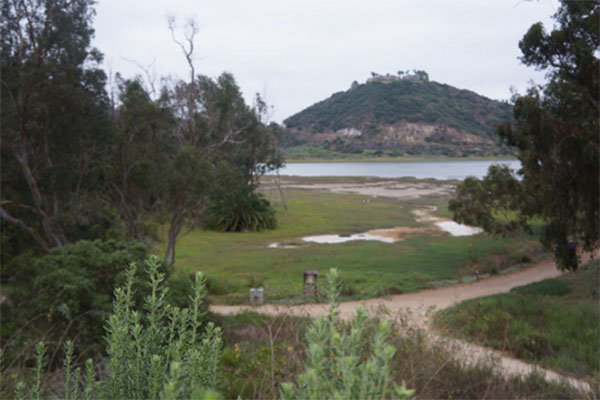
Jumping forward almost to the present, let’s look at the Batiquitos area one million years ago. This was the Pleistocene Epoch of the Cenozoic Era, and there were major climate changes. North America was in the grip of the Ice Ages. Ice sheets were sculpting the lands in the north, and valley glaciers were carving the mountains of the Sierras. (There were no glaciers in Southern California.) The Batiquitos area was now a flat, grassy plain. A stream was meandering across it on its way to the ocean. Its mouth was many hundreds of feet farther west than at present, because sea level was much lower all over the world. The ice sheets had trapped the precipitation formed from water evaporated from the oceans, thereby lowering sea level. At the coastline, the waves, much farther out than present shorelines, were cutting new terraces, which became covered by beach sands and shells, just like the beach today.
The land bounced upwards frequently because of movement along the San Andreas, Rose Canyon, and other faults, raising old beaches high above sea level. Today, the old beaches lie elevated above the present beach. We can see them from the trail along the lagoon. They are the flat tops of the surrounding hills, and look like gigantic steps down to the present beach. They can be seen many miles inland: the “Mesas” of San Diego are actually old wave-cut terraces. They have a reddish sediment deposited on them. The red color is an iron oxide (rust). This means the sediment was deposited in very shallow water where oxygen was plentiful, and the iron in some of the minerals in the sediment could combine with oxygen, making iron oxides, or rust. (Iron does not rust much in deep water, because there is little free oxygen available). The youngest terraces are close to the ocean, and are the lowest.
Whenever land rises, the streams flowing across the plain cut down and make deep, large valleys. This happened along the San Diego County coastline. Then, as climate warmed, ice sheets melted and sea level rose, flooding the valley into an estuary, and causing the deposition of soft sediments, which would be eroded easily when sea level dropped again. These deposits make up the Bay Point Formation of Pleistocene age, less than 1 million years old. Look for very plentiful, but broken, oyster and clam fossils looking very modern near the East end of the lagoon trail. No collecting please.
Because we are so close to a plate boundary, sections of the land continue to move sideways or up or down along faults. A small up-down fault cuts through the sediments in the road-cut on La Costa Avenue near the freeway. It is difficult to see with the brush that has grown on the face of the cut. Geologists think it crosses the lagoon toward the northeast. The fault is older than the terrace sediments above it, which are not displaced by it, but appear to have been deposited after faulting.
The rest of the story is in the present. Batiquitos Lagoon exists today because the ice sheets of the last ice age melted 11,000 years ago and sea level rose, flooding the deep stream valley. (This makes our “lagoon” technically an estuary rather than a lagoon, as are the others along the coast of San Diego County. Lagoons are bodies of ocean water, which have been cut off from the sea by sand deposits, and they have no freshwater streams flowing into them, according to geographic definitions. But our estuaries carry the word “Lagoon” in their names, so “Lagoons” they will remain.)
Lagoons and estuaries are not permanent features, however. Sediment coming into them is rarely all cleared out by tides. San Marcos and Encinitas creeks, entering Batiquitos at the eastern end, drop their sediment when they reach still water, and muds brought in by tides get dropped into the Lagoon as well. The Lagoon silts up. Our Lagoon would have disappeared with this natural process, had it not been rescued by dredging so that it can once again be a flushing tidal lagoon. New sediments are always being deposited. Human intervention has been necessary often since the Lagoon was restored in the mid-1990s. And, by the way, we are only in a warm interglacial period. If global warming doesn’t stop it, a new ice age could once again lower sea levels around the world, draining the Batiquitos of ocean water. Right now, however, sea level appears to be rising slightly around the world.
Because we are on a slice of the Pacific Plate and will continue to move, earthquakes will continue to shake and possibly raise the land again. So this is not the end of the geologic story of Batiquitos Lagoon. Come back and visit in 100,000 years and see if there is still a Lagoon here, and if there are new “mesas” in San Diego County.
Joan K. Lubowe
Revised 12-28-04
SOURCES:
Abbott,Patrick. 1999. The Rise and Fall of San Diego. Sunbelt Publications
Bergen, et al. 1997. Geology of San Diego County. Sunbelt Publications.
Educational materials prepared for the San Diego Natural History Museum.
Batiquitos Lagoon Foundation is a 501c3. For EIN and Tax Information, contact us today.
HOME
Visiting the Lagoon
Upcoming Events
ABOUT
About the Lagoon
The History
Photo Gallery
Geology
Plants
Birds
Fish
SEE & DO
View Events
Walk the Lagoon
Speaker Series
Download Newsletters
Schedule a Walk
THE FOUNDATION
The Lagoon Success
Volunteer
SUPPORT
Donate
Become a Member
Volunteer
Brick Program
CONNECT
Contact Us
Partner with Us
Facebook
COPYRIGHT © 2020 BATIQUITOS LAGOON FOUNDATION
Terms of Service
Privacy Policy
Curated by
McLeod Media